Drones at the service
of your job sites
Progress tracking, mapping, volumes, inspection: precise site data and striking imagery, delivered without disrupting your work.
Site applications
Data that moves
the site forward
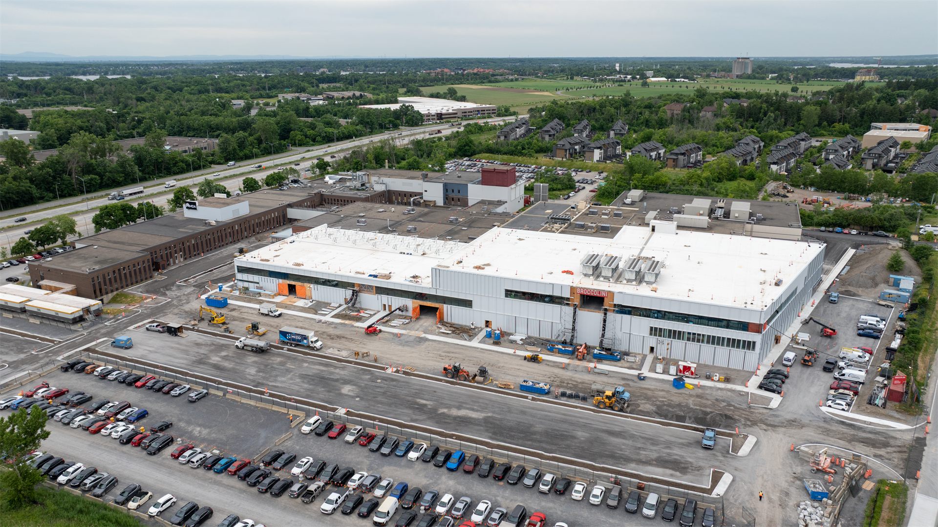
Progress tracking
Periodic flights from the same angles, comparisons over time and dated documentation: the real evolution of the site, visible at a glance.
Mapping and 3D modeling
Orthophotos, georeferenced surveys and digital twins of the site, compatible with your design tools and BIM workflows.
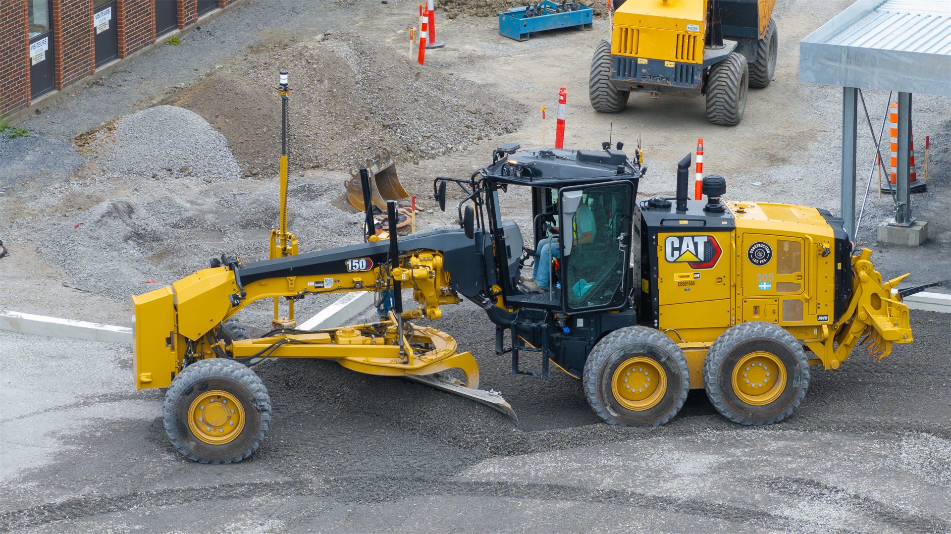
Volume calculation
Stockpiles, excavations and backfill measured with rigour, to support your progress claims and track quantities from one pass to the next.
Structure inspection
Roofs, facades and works inspected without scaffolding or lifts, with precise visual documentation for your technical teams.
Site monitoring
A regular eye on the perimeter and sensitive zones of the site, to deter intrusions and document conditions.
Promotion and public relations
Spectacular aerial photos and videos of the project, for your bids, presentations and brand communications.
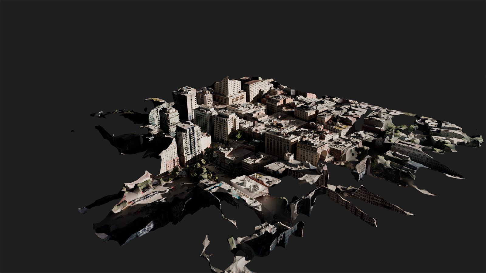
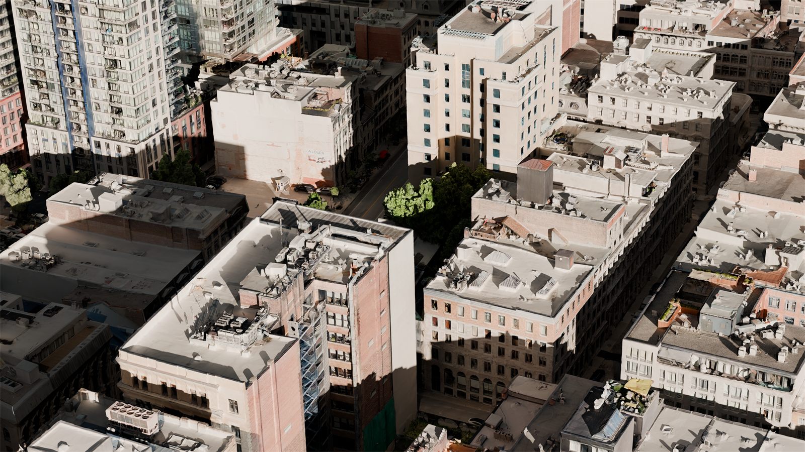
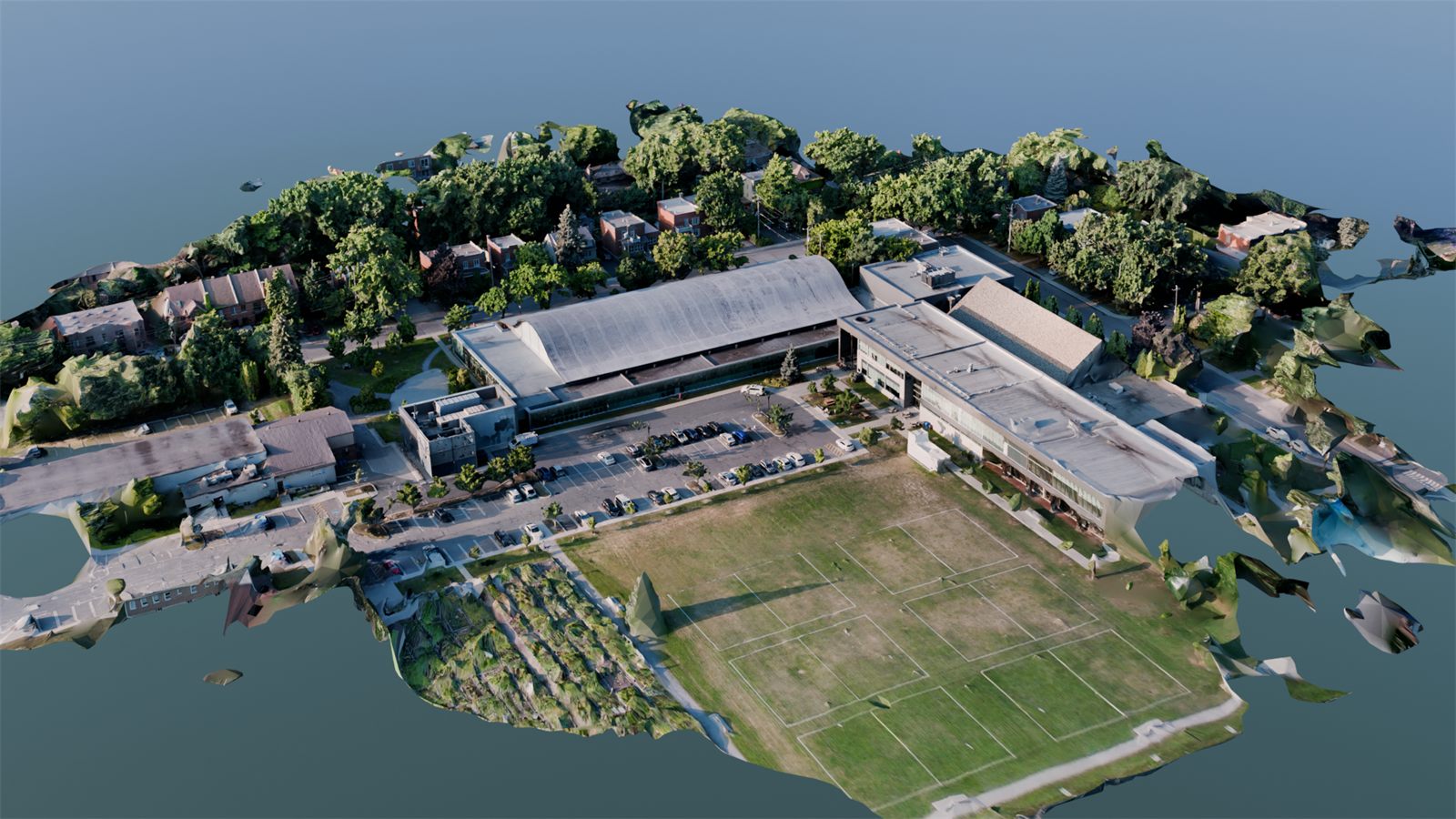
3D modeling
Your site, as a measurable
digital twin
From data captured by drone, we rebuild your site as a faithful, measurable, shareable 3D model.
Visualize existing conditions before designing, track the build during the work, present the project to decision makers and integrate the models into your BIM tools. 3D modeling turns the site into usable data.
- Transport Canada compliance
- Liability insurance
- Certified specialists
- One point of contact
The TREO model
One point of contact, like your general contractor
You know the model: one accountable lead who coordinates the trades and answers for the result. TREO applies the same logic to drone work.
Transport Canada authorizations, airspace, insurance, safety, certified specialists and data processing: we manage the entire mandate and deliver results that are ready to use. Your site team has nothing to coordinate.